

Hujingyu
Attractions
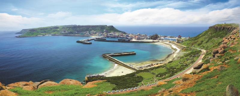
Hujingyu is the seventh largest island in the Penghu archipelago. It is known for its majestic basalt column formations and is located along the Tropic of Cancer (23.5 degrees North). In 2020, it was selected as one of Taiwan's classic small towns. The port of Hujingyu is located in the center of the settlement, where you can often see cats lazily basking in the sun, stretching and strolling around. Due to the high density of cats on the island, it has been dubbed "Cat Island."
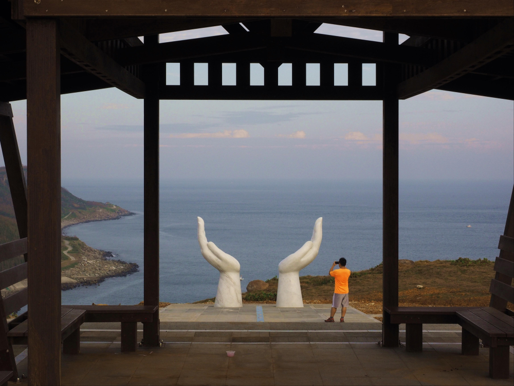
Geographically, the island is divided into two mountains, one on the east side and the other on the west, with the settlement located between them on a narrow land formed by coral fragments. Strategically located between Penghu Bay and Magong Harbor, Hujingyu holds considerable military value, as many vessels passing in and out of the harbor navigate the surrounding waters. To this day, the eastern mountain of Hujingyu remains a military restricted area. After the military withdrew from the area, the western mountain was transformed into a public park and recreational area. A 55-meter-long Sun-Chasing Avenue(追日大道) was constructed, with a giant hand sculpture at the end of the pathway, resembling a welcoming gesture to embrace the falling sunlight.
The military site ruins on the western mountain were once rumored to have been the "Southward Command Post of Admiral Isoroku Yamamoto, who led the attack on Pearl Harbor." However, it was later identified as a small "military observation post." During the Japanese occupation, in addition to the coastal defense artillery station established by the Imperial Japanese Navy on the western mountain, two "Type B Defense Posts(乙種防備衛所)" were constructed on the northwest and southwest sides. These posts were equipped with underwater listening devices (passive sonar) to monitor potential U.S. submarines and other underwater threats. Along with the "Type A Defense Post(甲種防備衛所)" on Wai'an in Xiyu, they formed a defensive barrier to monitor underwater activities in Magong Harbor, emphasizing the strategic importance of the area.
The "Hujing Xishan North End Defense Post (虎井西山北端防備衛所)," is covered in basalt stones. Its exterior features a northern entrance, a central watchtower at the top, and a southern entrance. Inside, it consists of a semi-underground concrete bunker in a narrow shape. Approximately 280 meters southeast lies the "South End Defense Post(南端的防備衛所)," surrounded by a stone windbreak wall to shield it from northern winds. This post houses a multi-angular building made of stone and concrete, with large windows on all four sides. Inside, it contains a main control room, machinery rooms and other compartments designed specifically for operating the Type 97 underwater listening device. To the north of the listening post, there are two barracks, one large and one small, which served as living quarters for the coastal defense artillery personnel. Both are surrounded by stone windbreak walls to the west and north, with nearby support facilities such as a power station and cooling tanks. Further north, there is another building enclosed by a stone windbreak wall.
The "Hujing Xishan North End Defense Post (虎井西山北端防備衛所)" was once mistakenly rumored to be the command post of Admiral Isoroku Yamamoto's southward campaign. However, after thorough research, these claims have been proven false. In reality, the Japanese military bunkers on Hujingyu Xishan (western mountain) were neither secret bases for Yamamoto's attack on Pearl Harbor, nor command posts for the Second Fleet's southward operation toward Malaya and the Philippines. They were not simply ordinary "coastal defense posts" or "observation stations" either."
Transportation Information: For detailed ferry schedules, please refer to the timetable provided by the Magong City Office.
Source: Penghu Travel, Tourism Administration, Ministry of Transportation and Communications, Penghu National Scenic Area Administration Court, Penghu County Government (Time Traveler Military Experience),Changes in Military Deployment: Focusing on Penghu Before 1945,Wartime Log of the Makung Naval Defense Headquarters, December 8, 1941 – May 31, 1942 (Showa 16–17)
- Theme Category
- Attractions Natural Attractions